· Scott Hosking · Article · 3 min read
Strengthening Arctic Resilience: AI and Satellites Take Center Stage at Arctic Frontiers 2026
Bird’s Eye View: AI and Satellites for Arctic Resilience
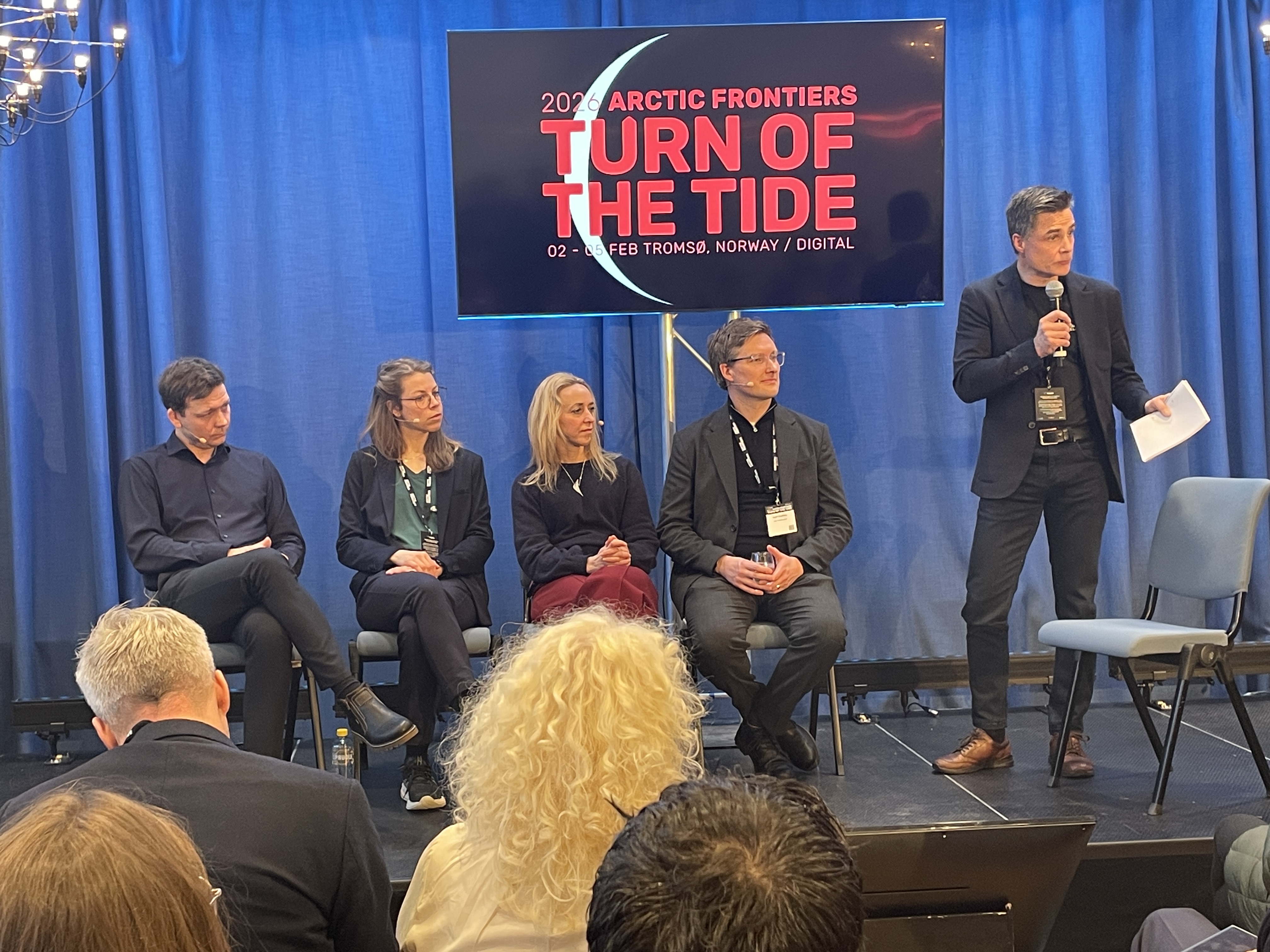
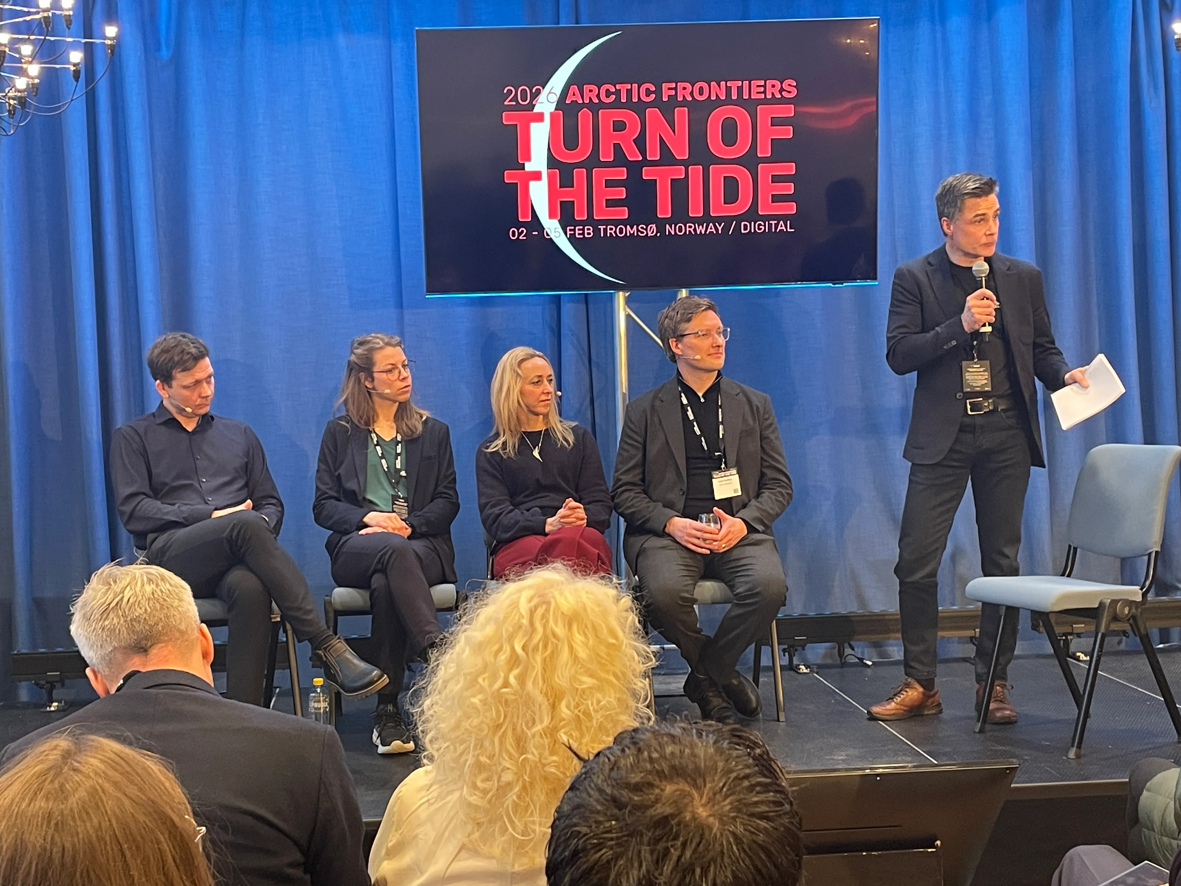
At the Arctic Frontiers 2026 conference in Tromsø, a pivotal side session titled “Bird’s Eye View: AI and Satellites for Arctic Resilience” highlighted the growing necessity of cross-border and cross-sector collaboration. Organised by the British Embassy Oslo in partnership with SFI Visual Intelligence and The Alan Turing Institute, the event brought together experts to discuss how cutting-edge technology can safeguard the fragile Arctic environment.
The session opened with remarks from the British Ambassador to Norway, Jan Thompson, on behalf of UK Space Minister Liz Lloyd, setting a collaborative tone for a panel that featured a powerhouse of technical expertise, including:
- Scott Hosking, Mission Director for Environment from The Alan Turing Institute, and Senior Researcher at British Antarctic Survey
- Robert Jenssen (Panel Chair) and Kristoffer Wickstrøm from SFI Visual Intelligence.
- Sara Björk, DevOps Developer at K-SAT (Kongsberg Satellite Services).
- Victoria Nockles, Principal Investigator at the Defence AI Research (DARe), The Alan Turing Institute
From Research to Real-World Impact: The Evolution of IceNet
One highlight of the discussion was the contribution of Scott, who presented our work on IceNet. Originally developed as a research-grade AI model for sea-ice forecasting, IceNet has now transitioned into a vital tool for delivering decision-making.
Scott emphasised two critical shifts in how AI is being deployed for Arctic resilience:
- Ecological & Infrastructure Resilience: IceNet is no longer just a predictive exercise; it is actively supporting ecological conservation—such as protecting caribou migration routes and infrastructure resilience, helping maritime operators navigate increasingly unpredictable waters safely.
- The Multimodal Revolution: The next wave of environmental AI is moving toward multimodal capabilities. Scott noted that for forecasting to be truly effective, models must be able to ingest and digest the messy data: combining high-resolution gridded satellite data with fragmented, in-situ off-grid datasets from ground sensors and local observations (building on approaches such as those seen in Aardvark Weather).
A Collaborative Path Forward
The presence of partners like SFI Visual Intelligence and KSAT underscored that the future of Arctic monitoring relies on a pipeline of innovation, from the satellite sensors in orbit to the AI architectures that translate that data into actionable insights for policymakers.
By bridging the gap between high-level AI research and the practical needs of Arctic operators, this session — facilitated by the British Embassy Oslo — showcases how international science diplomacy is key to navigating the “Turn of the Tide” in the High North.

.Co8fmQq4.jpg)